I'm supposing that by "medieval map" OP means maps such as this (more on that below) so here goes:
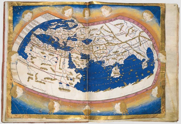
The best example to use is the Hereford Cathedral's Mappa Mundi. Professor Robert Barlett discusses this map, and related phenomena, in the BBC program "Inside the Medieval Mind" .
The example of the Hereford Map linked here has modern text explaining what the various places and man / animals / manimals (more on that later) are supposed to represent, but doesn't cover the whole map.
I'm going to get into what catches most modern observers off guard - including me myself, admittedly - first:
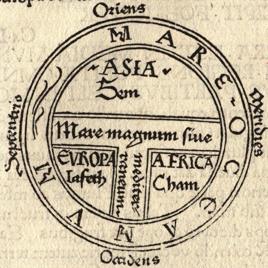
The Hereford map, and other Western European maps from the time, don't follow conventions that Greek / Roman and Arabian maps used. Instead, it's a T and O map. Isidore of Seville, who provide this example in his "Etymologiae", describes the map further:
"The [inhabited] mass of solid land is called round after the roundness of a circle, because it is like a wheel [...] Because of this, the Ocean flowing around it is contained in a circular limit, and it is divided in three parts, one part being called Asia, the second Europe, and the third Africa"
There are several conscious choices in the Hereford map as well as in other T and O maps:
*Jerusalem is in the middle. The Tower of Babel is to the north (or east? This map's North = "normally" East in this map after all). And at the highest point? Paradise, with the angels gathered.
*The further away you get from Jerusalem, the stranger (to modern eyes) creatures and manimals start to appear. Unicorns, phoenix and minotaurs are present on the map alongside more "normal" animals. This is not mentioning the "strange" manimals such as Blemys and dogheads existing far away from Jerusalem.
The existence of stranger animals and manimals together with religious imagery is very telling of the medieval geographical imagination: as Prof. Barlett notes, the animals / manimals and other such creatures were real and ever-present in reports and debates of the time.
One final note: the T and O map does not imply a flat earth any more then the Greek and Arabic maps do. The myth of medieval flat earth been debunked here for example.
Hope this answer helps!