Source: #3 at http://chamorrobible.org/gpw/gpw-200905.htm ... 1200 x 786 pixels ... 2000 x 1310 pixels ... 3000 x 1966 pixels ... 3563 x 2335 pixels
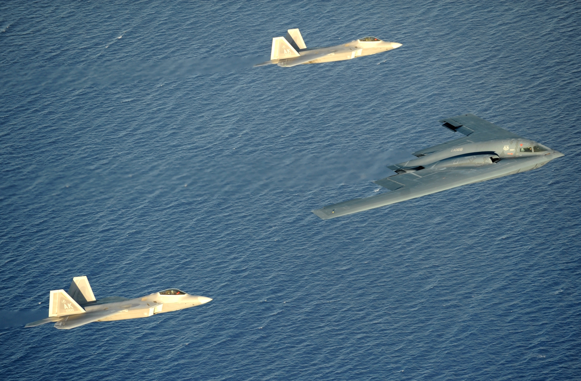
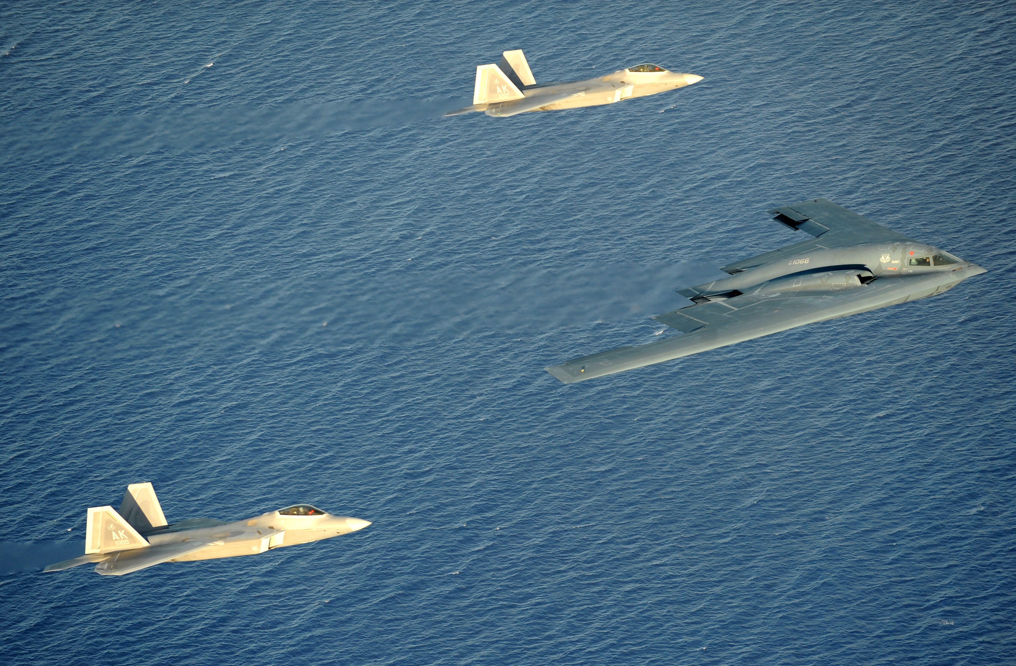
- Watch "Island Stealth: F-22A Raptors and a B-2 Spirit Over Guam, USA" (Larger Version), April 2009: https://www.youtube.com/watch?v=kVP_8afut1s
"Guam - Tip of the spear" by Dr. Carlo Kopp, published March 2009: http://www.ausairpower.net/SP/DT-Guam-March-2009.pdf
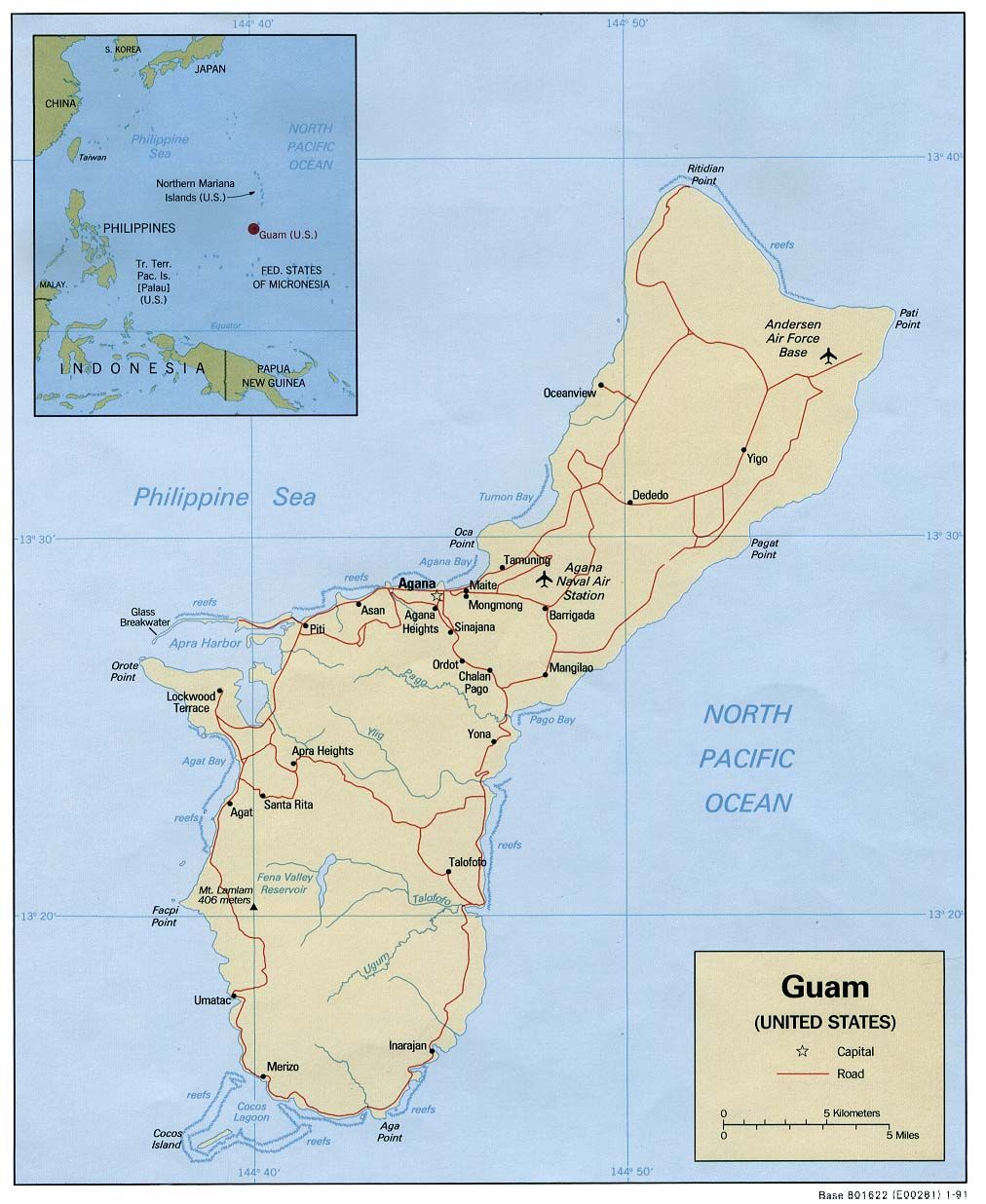
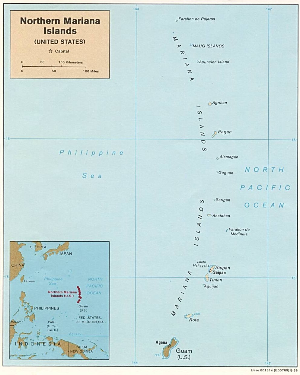
(a) Where are geostrategically important Territory of Guam, USA and Commonwealth of the Northern Mariana Islands (CNMI), USA?
- http://chamorrobible.org/images/chamorrobibleproject/map-west-pacific-islands-1998.jpg (via)
- http://chamorrobible.org/images/chamorrobibleproject/map-guam-1991.jpg (via)
- http://chamorrobible.org/images/chamorrobibleproject/map-commonwealth-of-the-northern-mariana-islands-1989.jpg via
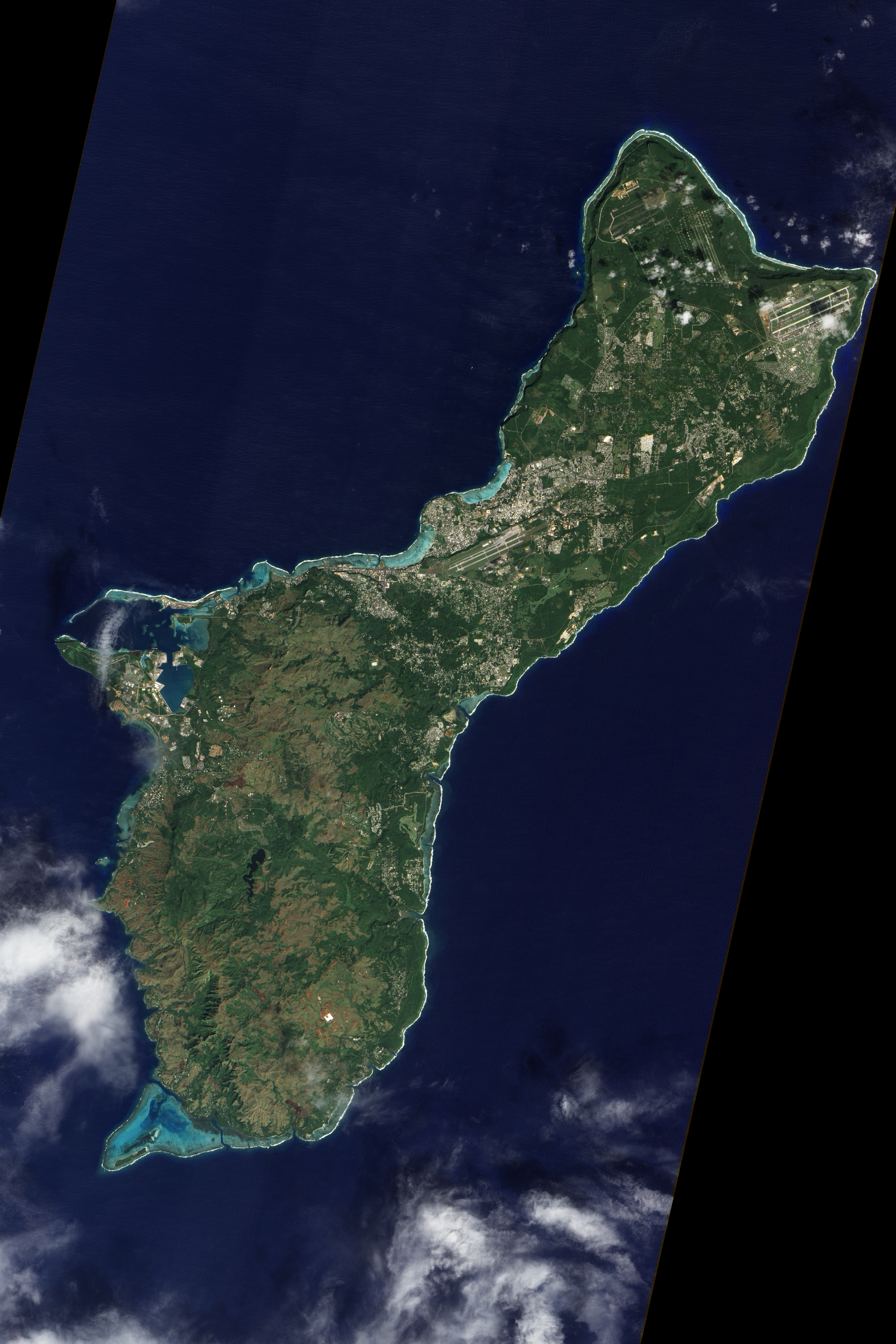
- http://chamorrobible.org/images/photos/gpw-201304-NASA-Philippine-Sea-Pacific-Ocean-Guam-20111230-other.jpg (via, 2013 x 3020, 2680 x 4020, 4014 x 6021)
Via: http://chamorrobible.org and http://chamorrobible.org/gpw/gpw.htm
Western Pacific Ocean sunset photographed from the International Space Station by an astronaut orbiting above the Philippine Sea (latitude 20.2, longitude 131.7) on 21 July 2003 at 10:17:20.420 GMT: 3032 x 1986 pixels (via - via)